Flood Advisory Issued for Bay and Washington Counties Until Late Evening
Heavy thunderstorms prompted flood advisories across Bay and Washington counties, with minor flooding expected in Panama City and surrounding areas.

TALLAHASSEE, FLORIDA — The National Weather Service issued a flood advisory for parts of the Florida Panhandle on June 1, warning residents of Bay and Washington counties about flooding from thunderstorms.
The advisory, which took effect at 7:12 p.m. EDT on June 1, remained in place until 10:15 p.m. EDT the same evening. Doppler radar detected heavy rain from thunderstorms at 6:11 p.m. CDT, with minor flooding either ongoing or expected to begin shortly across the affected areas.
Areas Expected to Experience Flooding
Weather service officials identified numerous locations within the advisory area that would likely experience flooding conditions. These communities include Panama City, Lynn Haven, Panama City Beach, Springfield, Hiland Park, and Tyndall Air Force Base.
Other areas expected to see flooding include Ebro, West Bay, Bid-a-Wee, Bahama Beach, Edgewater Gulf Beach, and West Panama City. The advisory also covered Gulf Resort Beach, Gulf Lagoon Beach, Vicksburg, Laird, Southport, Magnolia Beach, Biltmore Beach, and Seminole Hills.
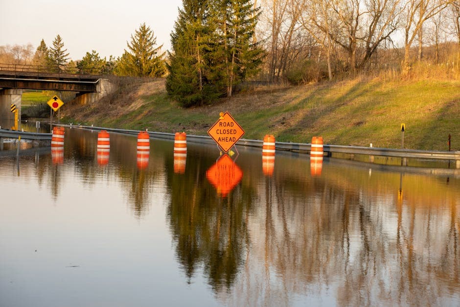
Expected Impacts and Safety Concerns
The National Weather Service warned that minor flooding would primarily affect low-lying areas and locations with poor drainage systems. Officials noted that water ponding in urban areas and other locations was either occurring or expected to begin imminently.
The weather service emphasized flood safety during such conditions. Residents in affected areas were advised to monitor local conditions and avoid driving through flooded roadways, as even shallow water can pose significant risks to vehicles and pedestrians.
Thunderstorm Activity and Radar Observations
Meteorologists used Doppler radar technology to track the storm system responsible for the heavy rainfall. The radar observations at 6:11 p.m. CDT confirmed that thunderstorms were producing significant precipitation amounts across the Florida Panhandle region.
The National Weather Service continues to monitor weather conditions across the state and issues advisories when flooding or other hazardous weather conditions threaten public safety. Residents can access current weather information and safety guidelines through the National Weather Service website.