Heat Advisory Extends Through July 4 Weekend Across Missouri
A Heat Advisory stretching from late June through July 3 covers much of Missouri as heat index values hover near 100 degrees — just as the Independence Day weekend gets underway.

SPRINGFIELD, MISSOURI — The National Weather Service in Springfield has extended a Heat Advisory through 9 p.m. CDT Friday, July 3, covering large portions of Missouri and southeast Kansas, as daily heat index values are expected to reach around 100 degrees through the holiday weekend.
The advisory, updated June 29 at 1:30 a.m. CDT, affects portions of central, east central, south central, southwest, and west central Missouri, as well as parts of southeast Kansas. Residents in those areas are urged to take precautions against heat-related illness through the extended stretch of hot and humid weather.
Days of Dangerous Heat
The National Weather Service first issued a Heat Advisory for the region on June 27 at 1:17 p.m. CDT, with the warning initially set to expire July 2 at 8 p.m. CDT. The agency extended the advisory on June 29 to cover through July 3 at 9 p.m. CDT, reflecting the persistence of dangerous conditions heading into the Independence Day weekend.
According to the National Weather Service, the combination of hot temperatures and high humidity creates conditions that may cause heat illnesses. Officials warn that residents should limit outdoor activity during peak afternoon hours, stay hydrated, and check on elderly neighbors and those without access to air conditioning.
Flooding Threat Passes in South Central Missouri
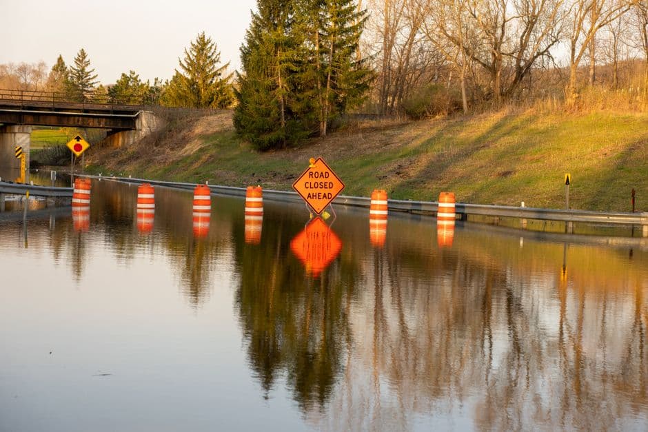
While the heat dominates the forecast going forward, parts of southern Missouri dealt with a separate weather threat earlier this week. The National Weather Service issued a Flood Warning on June 27 at 2:58 p.m. CDT for portions of south central and southwest Missouri, including Howell and Texas counties in south central Missouri, and Douglas and Wright counties in southwest Missouri.
Doppler radar at the time detected heavy rainfall from thunderstorms, with between one and three inches of rain falling across the warned area. Flooding was reported as ongoing or imminent at several specific low water crossings, including the Eleven Point River at County Road 1550, Fox Creek at County Road 246, North Fork River at Highway EE, North Prong Jacks Fork at Arroll Road, South Fork Jacks Fork River at Stillhouse Road, Bryant Creek at Highway U, and Bryant Creek at County Road 223.
Communities affected included Mountain View and Willow Springs, among other locations in the region. The Flood Warning expired June 28 at 2:45 p.m. CDT, with the National Weather Service confirming that flooding was no longer expected to pose a threat. Officials asked drivers to continue observing any remaining road closures in the area.
What Residents Should Know
The National Weather Service continues to monitor conditions across the region as the Heat Advisory remains in effect. The agency’s Springfield office is responsible for issuing weather alerts across a wide swath of Missouri and portions of neighboring states.
Residents in the affected counties are encouraged to seek air-conditioned spaces during the hottest parts of the day and to never leave children or pets inside parked vehicles. Heat illness can develop quickly under index values near 100 degrees, particularly for the elderly, young children, and those working or exercising outdoors, according to the National Weather Service.