Flood Warning Issued for Grand River Near Pattonsburg Through Monday
Minor flooding forecast for Grand River near Pattonsburg as water levels expected to peak at 27.3 feet this afternoon.
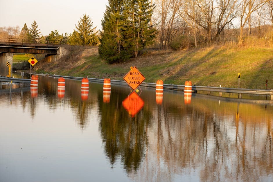
PATTONSBURG, MISSOURI — The National Weather Service in Kansas City/Pleasant Hill issued a flood warning for the Grand River near Pattonsburg, effective until Monday evening at 8:00 PM, affecting residents in Gentry and Daviess Counties.
Minor flooding is forecast for the area, with the river expected to reach 27.3 feet this afternoon before gradually receding. At 5:30 AM Sunday, the river stage measured 24.3 feet, approaching the 25.0-foot bankfull stage.
The river is predicted to rise above flood stage this morning and peak at 27.3 feet during the afternoon. Officials expect the water levels to fall below flood stage this evening, dropping to 5.1 feet by Monday evening.
Impact on Local Areas
When the Grand River reaches 25.0 feet, low-lying farmland in the region begins to experience flooding. The current forecast shows the river will exceed this threshold for most of Sunday before conditions improve.
Weather service forecasters predict the river will rise again to 6.4 feet on Tuesday morning before falling and remaining below flood stage for the foreseeable future.
Safety Precautions
The National Weather Service reminds residents that flood conditions can develop rapidly and pose significant dangers. Motorists should never attempt to drive through flooded roadways, as just six inches of moving water can knock down an adult and two feet of water can carry away a vehicle.
Farmers and residents in low-lying areas near the Grand River should monitor conditions closely and be prepared to move livestock and equipment to higher ground if necessary. The flood warning covers the period from early Sunday morning through Monday evening.
Updated river stage information and forecasts are available through the National Weather Service’s flood safety resources. Residents can stay informed about changing conditions by monitoring local weather alerts and official communications from emergency management officials in Gentry and Daviess Counties.