Minor Flooding Continues on Missouri Rivers as Waters Begin to Recede
Two Missouri rivers remain above flood stage with minor flooding affecting farmland and boat launches in Vernon and St. Clair counties.
JEFFERSON CITY, MISSOURI — Minor flooding continues along two Missouri rivers as water levels slowly begin to drop, according to flood warnings issued by the National Weather Service Springfield office.
The Little Osage River near Horton and the Osage River at Taberville remain above flood stage, affecting Vernon County and parts of St. Clair County. Both waterways are experiencing minor flooding with impacts expected to continue into early May.
Current River Conditions
At 7:45 PM Wednesday, the Little Osage River near Horton measured 42.1 feet, more than one foot above the 41.0-foot flood stage. The river reached a peak of 42.4 feet within the previous 24-hour period, according to National Weather Service data.
The Osage River at Taberville stood at 23.4 feet Wednesday evening, just above the 23.0-foot flood stage. Forecasters expect this river to rise to a crest of 23.9 feet Thursday evening before beginning to recede.
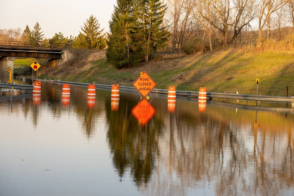
Flooding Impacts and Timeline
Minor flooding along the Little Osage River affects low-lying areas near the monitoring station and farmland along the waterway. The National Weather Service expects the river to fall below flood stage Thursday morning and continue dropping to 32.3 feet by Monday evening.
At the Osage River near Taberville, rising waters have flooded the handicapped access to the Osage River launch area. This river is forecast to remain above flood stage until Friday afternoon, with the flood warning extending until late Friday evening.
Weather Service Advisories
The National Weather Service issued the flood warnings Tuesday evening at 8:08 PM Central Daylight Time. The warning for the Little Osage River near Horton remains in effect until 2:00 PM today, while the Osage River at Taberville warning continues until 10:00 PM Friday.
Both rivers have exceeded their bankfull stages, which measure 41.0 feet for the Little Osage River and 23.0 feet for the Osage River. Bankfull stage represents the level at which water begins to overflow the main channel.
Residents in affected areas should monitor local conditions and avoid flooded roadways. The National Weather Service continues to track river levels and will update warnings as conditions change.