Major Flooding Hits Michigamme River in Upper Peninsula, Approaches Record Levels
Rivers in Michigan’s Upper Peninsula reached critical flood levels Monday night, with the Michigamme River approaching record heights and forcing evacuations in multiple counties.
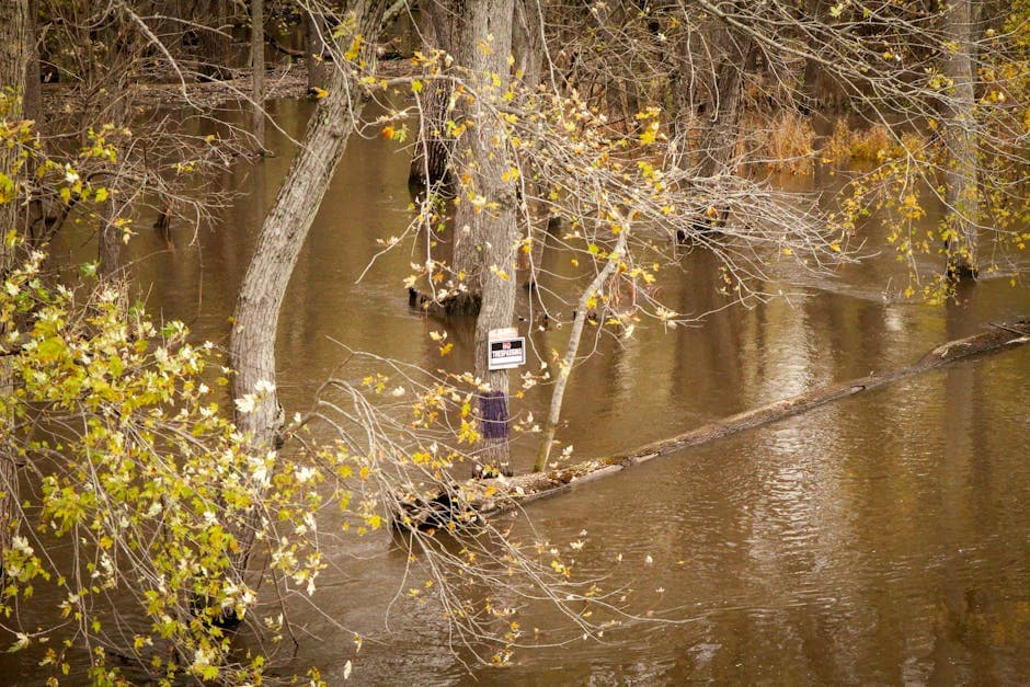
CRYSTAL FALLS, MICHIGAN — Major flooding struck the Michigamme River system in Michigan’s Upper Peninsula Monday night as snowmelt and reservoir releases pushed water levels to near-record heights across Iron, Dickinson and Marquette counties.
The National Weather Service in Marquette issued flood warnings for two sections of the Michigamme River late Monday evening, with the river near Crystal Falls reaching 9.0 feet at 11:45 PM CDT — well above the 8.0-foot flood stage and approaching historical flood records.
Minor flooding is occurring near Crystal Falls in Iron County, where the river exceeded its 7.0-foot bankfull stage and began flooding additional low-lying areas along the riverbank. The National Weather Service reported the river was flowing at approximately 3,700 cubic feet per second.
Major Flooding Near Witch Lake
Severe flooding developed near Witch Lake, where major flooding is occurring and forecast to continue until further notice. The river system in Dickinson and Marquette counties has reached critical levels due to snowmelt combined with recent rainfall.
At current levels near Witch Lake, water is inundating low-lying areas in Republic and South Republic, impacting yards of homes near Bengtson bridge on County Road LI. The flooding has begun covering portions of County Road LG located 2.6 miles northwest of M-95.
Weather service officials warned that if water levels reach 9.0 feet, flood waters would impact yards and homes near Bengtson bridge and along Floodwood Drive near the Michigamme River east of M-95. At that level, approximately six inches of water would cover portions of County Road LG northwest of M-95.
Infrastructure and Transportation Impacts
The flooding poses risks to local infrastructure and transportation routes. County Road LG faces potential coverage as water levels continue to rise, while residential areas near key bridges experience direct impacts to property.
The National Weather Service indicated that if flooding reaches 11.0 feet, flood waters would cover significant additional areas, though the warning was truncated in the official alert.
Both flood warnings remain in effect until further notice, with no specific forecast timeline provided by the National Weather Service. The agency attributed the flooding to a combination of seasonal snowmelt and increased releases from upstream reservoirs.
Residents in affected areas should monitor local conditions and heed evacuation orders from local emergency management officials. The flooding represents some of the most significant water level increases seen in the region in recent years, with current conditions approaching historical flood records for the Michigamme River system.