Flood Warning Issued for Meramec River as Severe Storms Hit Missouri
Minor flooding forecast for Meramec River near Arnold as severe storms with ping pong ball-sized hail swept through central Missouri Monday afternoon.
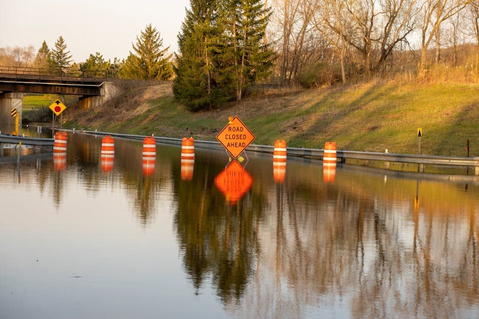
ARNOLD, MISSOURI — The National Weather Service issued a flood warning for the Meramec River near Arnold on Monday afternoon, advising residents that minor flooding is expected to begin late tonight and continue through Tuesday evening, May 5.
The river stood at 22.8 feet at 4:00 PM CDT Tuesday, according to the NWS St. Louis office. Forecasters predict the river will rise above the 24.0-foot flood stage late tonight, cresting at 29.4 feet early Saturday morning before falling below flood stage by early Monday afternoon.
“At 27.0 feet, Meramec Bottom Road between Wells Road and Kerth Road begins flooding near this height,” according to the flood warning issued at 4:34 PM CDT.
Severe Thunderstorms Bring Large Hail
The flood threat comes as severe thunderstorms moved through central Missouri Monday afternoon, prompting multiple warnings from the National Weather Service. A severe thunderstorm warning was issued for Cole County and Moniteau County at 2:18 PM CDT, warning of ping pong ball-size hail.
The storm system was located 9 miles southwest of High Point at 2:18 PM CDT, moving east at 60 mph. “People and animals outdoors will be injured. Expect damage to roofs, siding, windows, and vehicles,” the weather service warned.
A second severe thunderstorm warning followed at 2:23 PM CDT, tracking a storm near High Point that was producing quarter-size hail and moving east at 60 mph. “Damage to vehicles is expected,” forecasters said.
Multiple Communities in Storm Path
The severe weather impacted numerous communities across central Missouri, including Latham, High Point, Enon, California, Russellville, McGirk, Hickory Hill, Kliever, Lohman, Centertown, Jamestown, Brazito, St. Martins, Sandy Hook, Elston, Marion, Jefferson City, Wardsville and Taos.
Jefferson Landing Historic Site was among the state parks included in the warning area. Both severe thunderstorm warnings expired at 3:00 PM CDT Monday.
River forecasts are based on observed precipitation and forecast precipitation for the next 24 hours, according to the National Weather Service. Residents near the Meramec River should monitor conditions closely as water levels continue to rise through the week.