Strong Thunderstorm Stalls Over Butler, Howard Areas in West Georgia
A nearly stationary thunderstorm threatened 10 west Georgia communities with 40-50 mph winds, lightning, and flooding Saturday afternoon, prompting repeated NWS alerts.

BUTLER, GEORGIA — A strong, nearly stationary thunderstorm prompted back-to-back Special Weather Statements from the National Weather Service in Peachtree City on Saturday afternoon, as the slow-moving storm posed risks of damaging winds, lightning, and flooding across a stretch of west-central Georgia communities.
Storm Stalls Over Multiple Communities
The National Weather Service first issued a Special Weather Statement at 12:55 p.m. EDT, reporting a strong thunderstorm located over Howard, approximately 8 miles west of Butler. The storm was described as nearly stationary at that time, raising concerns about prolonged impacts in the immediate area.
A second statement followed at 1:35 p.m. EDT, with the storm still in the vicinity of Howard and Butler and continuing to show little movement. Radar data served as the source for both alerts, according to the National Weather Service.
Hazards Include High Winds, Lightning, and Heavy Rain
Meteorologists identified wind gusts of 40 to 50 mph, frequent cloud-to-ground lightning, and heavy rain as the primary hazards associated with the storm. Residents in affected areas were warned to expect minor damage to tree limbs and the displacement of light, unsecured outdoor objects.
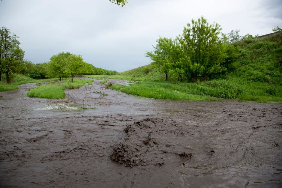
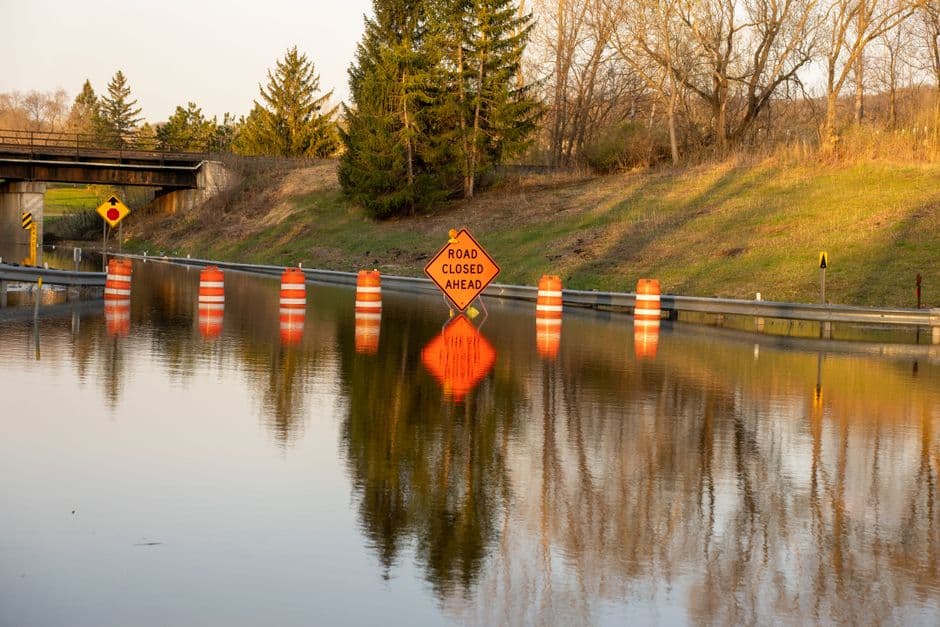
Heavy rainfall carried the additional risk of temporary street flooding, particularly in locations with poor drainage infrastructure, according to the National Weather Service alerts.
Affected Communities
The initial 12:55 p.m. statement identified Butler and Howard as the communities most directly in the storm’s path. By the time the 1:35 p.m. update was issued, the list of impacted locations had expanded significantly.
The National Weather Service identified the following communities as being in the affected area:
- Butler
- Junction City
- Howard
- Baldwinville
- Charing
- Prattsburg
- Carsonville
- Wesley Church
- Po Biddy Crossroads
- Mauk
Residents in those areas were advised to take precautions against wind hazards and potential flooding until the storm moved out of the region. The National Weather Service Peachtree City office continued to monitor conditions via radar as of the most recent statement.