Severe Storms Batter Philadelphia Region With Tornadoes, Flash Flooding
Tornado warnings, 60 mph wind gusts, and flash flood warnings blanketed the Philadelphia region Monday evening as a line of severe thunderstorms moved east — with flooding stretching from the suburbs into the Lehigh Valley past midnight.
PHILADELPHIA, PENNSYLVANIA — A powerful line of severe thunderstorms swept through the Philadelphia region on June 22, prompting tornado warnings, multiple severe thunderstorm warnings, and a series of flash flood warnings that stretched from southeastern Pennsylvania into southern New Jersey, with some flood warnings extending past midnight into the early hours of June 23.
The National Weather Service office in Mount Holly, New Jersey issued a Severe Thunderstorm Watch for the region beginning at 2:09 p.m. EDT, valid until 9:00 p.m. EDT, covering six Pennsylvania counties — Philadelphia, Bucks, Chester, Delaware, Montgomery, and Berks — along with 13 New Jersey counties and portions of Delaware and Maryland.
Tornado Warnings Strike Western Suburbs
The first tornado warnings of the evening were issued just before 5:00 p.m. EDT, as radar-indicated rotation was detected moving eastward through Chester and Montgomery counties. At 4:35 p.m., the National Weather Service issued a tornado warning after a severe thunderstorm capable of producing a tornado was located over Honey Brook, approximately 10 miles east of New Holland, moving east at 35 mph.
That warning covered southern Berks County, west-central Montgomery County, northeastern Chester County, and north-central Delaware County, and affected communities including Pottstown, Phoenixville, Coatesville, Downingtown, Collegeville, Royersford, Trappe, and Valley Forge, among others. The Pennsylvania Turnpike between mile markers 302 and 325 was also included in the warning area.
A second tornado warning was issued at 4:47 p.m. for a storm located over Glenmoore, about 13 miles northwest of West Chester, moving east at 35 mph, affecting Phoenixville, Coatesville, Downingtown, Collegeville, Royersford, Trappe, Elverson, Valley Forge, Paoli, Chester Springs, Lionville, Malvern, Exton, Thorndale, and Chesterbrook. A third tornado warning followed at 4:56 p.m. covering south-central Montgomery County, northeastern Chester County, and north-central Delaware County, including West Chester, Phoenixville, West Norriton, East Norriton, Downingtown, Valley Forge, Paoli, Newtown Square, King Of Prussia, Radnor Township, West Goshen, Malvern, and Exton.
A fourth tornado warning was issued at 5:05 p.m. for a storm located over Chester Springs, about 8 miles north of West Chester, moving east at 30 mph, again targeting West Chester, Phoenixville, West Norriton, East Norriton, Valley Forge, Paoli, Newtown Square, King Of Prussia, Lionville-Marchwood, Radnor Township, West Goshen, Malvern, Exton, Audubon, Chesterbrook, Eagleville, Devon-Berwyn, and Trooper, as well as the Pennsylvania Turnpike between mile markers 313 and 328 and Interstate 76 near mile marker 327.
Severe Thunderstorms Target Philadelphia and Surrounding Areas
As the storm system pushed east, severe thunderstorm warnings were issued in rapid succession throughout the late afternoon and early evening. At 5:22 p.m., a storm located over King Of Prussia, about 14 miles northwest of Philadelphia, prompted a warning covering Philadelphia County, southeastern Montgomery County, south-central Bucks County, northeastern Chester County, northeastern Delaware County, and northwestern Burlington County in New Jersey, with 60 mph wind gusts forecast.
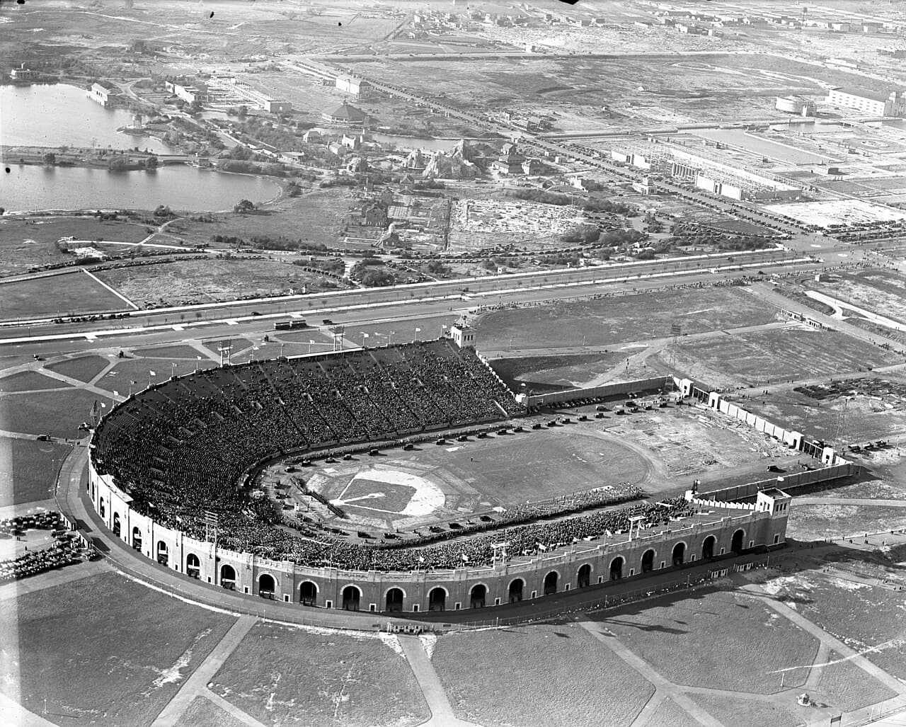
Two separate severe thunderstorm warnings were issued between 6:09 p.m. and 6:23 p.m. as storms moved through the Philadelphia and Camden area. Both warnings specifically noted that people at the Philadelphia Stadium should seek safe shelter immediately. Hazards included 60 mph wind gusts and quarter-size hail. Affected communities included Philadelphia, Camden, Gloucester City, Cherry Hill, Evesham, Mount Laurel, Chester, Deptford, Voorhees, West Deptford, Lindenwold, Bellmawr, Yeadon, Woodbury, Berlin, Folcroft, Paulsboro, Magnolia, Westville, and Woodbury Heights. Those warnings covered portions of Interstate 95 in Pennsylvania between mile markers 7 and 22, the New Jersey Turnpike between exits 3 and 4, and Interstate 295 in New Jersey.
An earlier severe thunderstorm warning at 2:29 p.m. had also been issued for a storm located over Tacony, near Philadelphia, moving northeast at 30 mph, with 60 mph wind gusts and penny-size hail, affecting Philadelphia, Camden, Bensalem, Willingboro, Lumberton, Florence, Burlington, Bristol, Mount Holly, Riverside, Palmyra, Beverly, Rockledge, Yardley, Tullytown, Langhorne, Wissinoming, Feasterville-Trevose, Florence-Roebling, and Cherry Hill Mall, as well as Interstate 95 in Pennsylvania between mile markers 24 and 40.
Flash Flooding Spreads Across the Region Into Early Morning
The National Weather Service issued a Flood Watch at 3:58 p.m. EDT covering southeastern Pennsylvania — including Philadelphia, Delaware, Eastern Chester, Eastern Montgomery, Lower Bucks, Upper Bucks, Western Chester, and Western Montgomery counties — along with portions of New Jersey and northern Delaware, valid through 6:00 a.m. EDT on June 23. Forecasters warned that showers and thunderstorms with rainfall rates of 1 to 2 inches per hour were expected, sufficient to trigger flash flooding in urban areas.
The first flash flood warning for the Philadelphia area was issued at 6:02 p.m. EDT, covering northeastern Delaware County, southeastern Montgomery County, and northwestern Philadelphia County, after Doppler radar detected between 1 and 1.5 inches of rain already fallen, with additional amounts of 0.5 to 1.5 inches possible. Flooding was already occurring at that time. Communities affected included Philadelphia, Conshohocken, Jenkintown, Narberth, Chestnut Hill, Germantown, Plymouth Meeting, and Bryn Mawr.
Additional flash flood warnings were issued at 6:26 p.m. for northeastern Philadelphia County, southeastern Montgomery County, southeastern Bucks County, and northwestern Burlington County in New Jersey, and at 6:36 p.m. for central Philadelphia County and northwestern Burlington County. Those warnings covered Philadelphia, Riverside, Palmyra, Wissinoming, Tacony, Pennsauken, Cinnaminson, and Riverton, and included Interstate 76 in Pennsylvania near mile marker 340 and Interstate 95 in Pennsylvania between mile markers 26 and 31.
By 9:04 p.m., radar and automated gauges showed between 1 and 2.5 inches of rain had fallen across portions of the Philadelphia suburbs. A flash flood warning issued at that time covering communities including Philadelphia, Conshohocken, Jenkintown, Narberth, Chestnut Hill, Germantown, Plymouth Meeting, Bryn Mawr, Trout Lake, Radnor Township, King Of Prussia, and West Conshohocken included Interstate 476 in Pennsylvania between mile markers 10 and 19 and Interstate 76 between mile markers 328 and 339.
A separate flash flood warning issued at 9:06 p.m. covered a broader area including Philadelphia, Bensalem, Florence, Burlington, Bristol, Beverly, Rockledge, Tullytown, Abington, Bryn Athyn, Andalusia, and Feasterville-Trevose, with Interstate 295 in New Jersey between mile markers 48 and 56, the New Jersey Turnpike between exits 6 and 6A, and Interstate 95 in Pennsylvania between mile markers 31 and 40 included in the warning zone.
The flooding threat extended well north of the city into the Lehigh Valley overnight. At 11:21 p.m. EDT on June 22, the National Weather Service issued a flash flood warning for central Northampton County, valid until 3:30 a.m. EDT on June 23. Doppler radar indicated between 1 and 2 inches of rain had already fallen, with an additional 1 to 2 inches possible. Flash flooding was ongoing or expected to begin shortly in Easton, Bethlehem, Forks, Wilson, Nazareth, Pen Argyl, Wind Gap, Bath, Belfast, West Easton, Tatamy, and Steuben. Interstate 78 in Pennsylvania between mile markers 70 and 76 was included in that warning.
Residents throughout the region were urged to avoid flooded roadways, underpasses, and low-lying areas. The National Weather Service warned that flooding of small creeks and streams, urban streets, highways, and drainage areas was occurring or expected across all warned zones throughout the evening.
Related Local News
Sources
- api.weather.gov
- api.weather.gov
- api.weather.gov
- api.weather.gov
- api.weather.gov
- api.weather.gov
- api.weather.gov
- api.weather.gov
- api.weather.gov
- api.weather.gov
- api.weather.gov
- api.weather.gov
- api.weather.gov
- api.weather.gov
- api.weather.gov
- api.weather.gov
- api.weather.gov
- api.weather.gov
- api.weather.gov
- api.weather.gov
- api.weather.gov
- api.weather.gov
- api.weather.gov
- api.weather.gov
- api.weather.gov
- api.weather.gov