Multiple Missouri Rivers Under Flood Warnings as Waters Rise Statewide
Rivers across Missouri surge past flood stage with some approaching record levels, threatening communities and closing roads through the weekend.

KANSAS CITY, MISSOURI — The National Weather Service issued multiple flood warnings across Missouri on Friday morning as several rivers exceeded flood stage, with moderate flooding occurring on multiple waterways and threatening rural communities through early next week.
The Platte River near Agency in Buchanan County reached 22.9 feet at 8:30 AM CDT Friday, well above the 20.0-foot flood stage, according to the National Weather Service Kansas City/Pleasant Hill office. The river is forecast to crest at 29.1 feet just after midnight Friday night before gradually receding below flood stage by early Monday afternoon.
“At 20.0 feet, low-lying areas east of Agency begin to flood,” the weather service stated in its flood warning. “At 30.0 feet, many farm levees along the river are overtopped and nearly all rural roads are under water.”
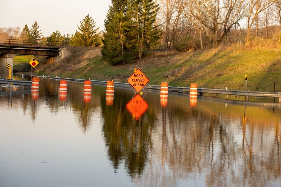
Rosendale Faces Severe Flooding Risk
The most severe flooding is occurring on the 102 River at Rosendale, where waters reached 19.7 feet at 7:25 AM CDT Friday. The river is expected to rise to 22.4 feet Friday afternoon, approaching record flood levels and threatening the community with significant damage.
At current levels, State Route 48 on both the east and west sides of Rosendale is expected to be underwater, preventing travel in or out of the town. Weather service officials warned that at 23.0 feet, homes and businesses in Rosendale would be threatened by floodwaters, and at 24.0 feet, eighty percent of the community’s homes and businesses could be flooded.
Additional Rivers Exceed Flood Stage
The Tarkio River at Fairfax reached 19.6 feet at 8:15 AM CDT Friday, with moderate flooding affecting Holt and Atchison Counties. The river is forecast to rise to 21.3 feet Friday afternoon before falling below the 17.0-foot flood stage later Friday evening. However, waters are expected to rise above flood stage again Saturday afternoon, reaching 18.8 feet by early Sunday morning.
At current levels, U.S. Highway 59 north of Fairfax is beginning to flood, and flooding has begun in the vicinity of Corning, according to weather service reports.
The 102 River at Maryville, currently at 13.5 feet, is forecast to rise above the 18.0-foot flood stage early Saturday afternoon, reaching 19.0 feet by Saturday evening. This flooding will affect Nodaway and Andrew Counties, with the east bank of the river flooding and water approaching the village of Arkoe.
Warnings Extended Through Weekend
Flood warnings remain in effect for varying durations across the affected areas. The Platte River warning extends until June 9 at 2:12 PM CDT, while warnings for the 102 River locations continue through Sunday evening for Maryville and early Monday afternoon for Rosendale. The Tarkio River warning remains active until early Monday morning.
The National Weather Service advises residents in flood-prone areas to monitor conditions closely and avoid driving through flooded roadways. Agricultural areas are experiencing significant impacts, with farm levees being overtopped and rural roads becoming impassable in several locations.
All four flood warnings were issued or extended Friday morning by the National Weather Service Kansas City/Pleasant Hill office, which continues to monitor river conditions throughout the region.