Major Flooding Hits Central Missouri Rivers Following Heavy Rainfall
Heavy rainfall triggers major flooding along central Missouri rivers, with warnings in effect through Wednesday as water levels peak.
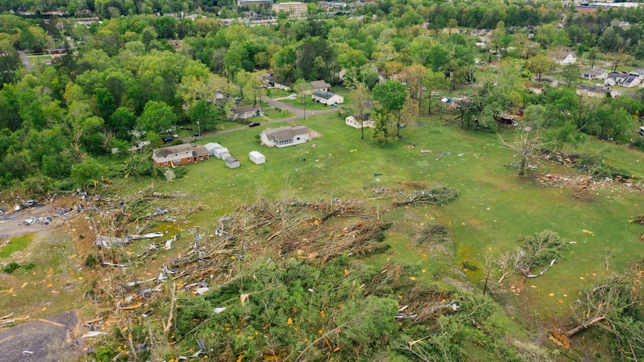
JEFFERSON CITY, MISSOURI — Flood warnings are in effect across central Missouri due to heavy rainfall causing significant flooding along several rivers and waterways. Hinkson Creek at Columbia is experiencing major flood conditions, and the Missouri River at Jefferson City is nearing peak levels.
The National Weather Service St. Louis issued flood warnings early Monday morning after Doppler radar indicated heavy rain from thunderstorms, with 2 to 4 inches of rainfall across the region. River levels remain elevated, though no additional rainfall is expected.
River Levels and Flood Status
Hinkson Creek at Columbia reached major flood stage with water levels at 20.7 feet as of 4:00 AM Monday, above the 18.0-foot flood stage. The creek peaked at 20.8 feet in the 24 hours prior to Monday morning and is expected to fall below flood stage later today, continuing to drop to 4.7 feet by early Thursday morning.
The Missouri River at Jefferson City stood at 22.6 feet at 4:45 AM Monday and is forecast to crest at 24.7 feet Monday evening before falling below the 23.0-foot flood stage Tuesday morning. At 24.5 feet, the Katy Trail floods near Rocheport, according to the National Weather Service.
The Osage River near Mari-Osa Campground is expected to rise above its 19.0-foot flood stage Monday afternoon, reaching a crest of 21.4 feet just after midnight before falling below flood stage late Tuesday evening. At 22.0 feet, a storage shed across the river from the gauge begins flooding.
Affected Communities
The flooding affects communities across southeastern Boone County, west central Callaway County, western Cole County, and eastern Moniteau County in central Missouri. Locations experiencing flooding include Jefferson City, California, Ashland, Columbia Regional Airport, St. Martins, Russellville, Jamestown, Centertown, McGirk, Easley, Hickory Hill, High Point, Marion, Lohman, Eugene, Hartsburg, Elston, Wilton, and Sandy Hook.
Officials warn that flooding of rivers, creeks, streams, and other low-lying and flood-prone locations continues throughout the warned areas. At Columbia, the Providence Road area just north of the gauge bridge remains at risk with water levels at the 20.9-foot mark.
Weather Service Warnings
The National Weather Service issued multiple flood warnings beginning early Monday morning, with some warnings extending through Wednesday. The initial flood warning for excessive rainfall was set to expire at 9:00 AM Monday, while river flood warnings remain in effect through varying timeframes depending on the waterway.
River forecasts are based on observed precipitation and forecast precipitation for the next 24 hours, according to the National Weather Service. The agency upgraded the Hinkson Creek flooding from minor to major severity and increased the duration of the warning as conditions worsened overnight.
Residents in flood-prone areas are advised to monitor current conditions and avoid driving through flooded roadways. The situation continues to develop as river levels fluctuate throughout the day.