Major Flooding Continues Across North Central Missouri, River at 31-Year High
Flooding forces numerous road closures as Chariton River reaches highest level since 1995 following heavy rainfall across north central Missouri.
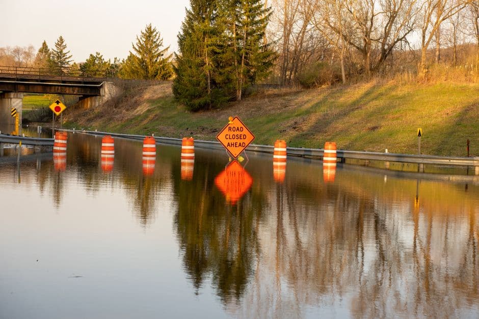
KANSAS CITY, MISSOURI — Severe flooding continues across multiple counties in north central and northeastern Missouri following heavy rainfall that dumped between 2 and 7 inches across the region yesterday, forcing numerous road closures and pushing the Chariton River to its highest level in more than three decades.
The National Weather Service Kansas City/Pleasant Hill issued flood warnings early Friday morning for ten counties, including Chariton, Grundy, Linn, Livingston, Macon, Mercer, Putnam, Sullivan, Adair, and Schuyler counties. The warnings remain in effect until 10:30 p.m. Friday.
Chariton River Reaches Critical Levels
The most severe flooding is occurring along the Chariton River near Prairie Hill, where the river reached 21.5 feet at 8:45 a.m. Friday morning, according to the National Weather Service. The river is forecast to crest at 22.0 feet Friday evening before beginning to recede.
This water level matches a previous crest of 22.0 feet recorded on May 24, 1995, making it the highest flood stage in 31 years. The flood stage threshold for the Chariton River is 15.0 feet.
At current levels, farmland and secondary roads throughout the Chariton River floodplain remain underwater. State Highway 129 is overtopped by floodwaters approximately 8 miles north of Salisbury, forcing detours for motorists traveling through the area.
Widespread Road Closures Continue
Transportation department officials report numerous state routes remain closed due to high water throughout the affected counties. Stream gauges within the warned areas indicate water levels are still rising in some locations, despite the rainfall ending.
The flooding follows severe thunderstorm activity that moved through the region Thursday afternoon and evening. The National Weather Service had issued tornado watches for portions of the area, including cities such as Kirksville, Brookfield, Chillicothe, Macon, Marceline, La Plata, and Trenton.
Recovery Timeline
The National Weather Service expects the Chariton River to fall below flood stage early Saturday afternoon. However, flooding impacts are expected to continue throughout Friday as water slowly recedes from roadways and low-lying areas.
Emergency management officials urge residents to avoid driving through flooded roadways and to stay informed about current road conditions before traveling. The flood warning for the Chariton River near Prairie Hill extends until Sunday afternoon.
No additional rainfall is forecast for the immediate area, which should allow water levels to gradually decrease over the weekend. Residents in affected areas should continue monitoring local conditions and heed all evacuation orders or road closure notices from local authorities.