Flood Warnings, Watches Issued Across Central Missouri Through Monday
Missouri River flooding continues while flash flood watches cover multiple counties as heavy rains target central Missouri through Monday.

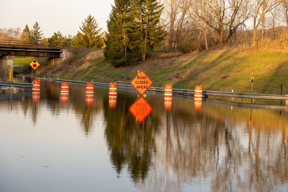
KANSAS CITY, MISSOURI — Multiple flood warnings and watches remain in effect across central Missouri through Monday afternoon as heavy rainfall threatens to cause flash flooding throughout the region.
The National Weather Service Kansas City office issued a flood warning for the Missouri River at Napoleon, affecting Lafayette, Ray and Jackson counties, which will remain active until Monday at 11:17 PM. Minor flooding is currently occurring at the Napoleon gauge, which reached 18.2 feet at 1:00 PM Sunday, exceeding the 17.0-foot flood stage.
“At 17.0 feet, low-lying areas unprotected by levees begin to flood,” according to the National Weather Service. The river is expected to fall below flood stage late this evening and continue declining to 11.3 feet by Friday morning.
Flash Flood Watches Cover Multiple Counties
Two separate flood watches cover a broader swath of central Missouri through Monday at 1:00 PM. The St. Louis Weather Service office issued a watch for Boone, Callaway, Cole, Moniteau and Osage counties, warning that flash flooding caused by excessive rainfall is possible.
The Kansas City office issued another flood watch covering Cooper, Howard, Pettis and Saline counties in central Missouri, along with Henry and Johnson counties in west central Missouri. Both watches warn of potential flooding in rivers, creeks, streams and other low-lying areas.
Heavy Rainfall Expected
Multiple rounds of showers and thunderstorms with very heavy rainfall are forecast across the watch areas through Monday morning. The National Weather Service predicts rainfall totals of 1 to 3 inches, with locally higher amounts possible in some areas.
Officials warn that flash flooding could occur where soils are already moistening from previous precipitation. Periods of heavy rain are expected with showers and thunderstorms continuing tonight into Monday morning across the affected regions.
The excessive runoff may result in flooding of rivers, creeks, streams and other flood-prone locations throughout central and west central Missouri. Residents in low-lying areas should monitor conditions closely and be prepared to take action if flooding develops.