Flood Warning, Heat Advisory Hit Missouri as Weather Extremes Strike
Missouri faces dual weather threats as flooding hits Boonville area while dangerous heat index values up to 108 degrees blanket the state through Tuesday.
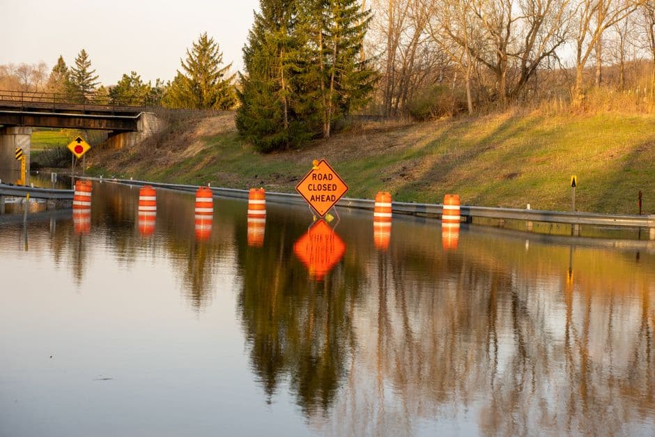
KANSAS CITY, MISSOURI — The National Weather Service issued multiple weather warnings for Missouri on Monday, with moderate flooding occurring along Petite Saline Creek near Boonville and dangerous heat index values expected to reach up to 108 degrees across portions of the state through Tuesday evening.
The flood warning for Petite Saline Creek in Cooper County remains in effect until Tuesday morning, with the creek rising to 19.1 feet as of 3:30 PM Monday. The National Weather Service forecasts the river will crest at 19.6 feet Monday evening before falling below the 16.0-foot flood stage late Monday night.
At current levels, the flooding affects low-lying woodlands and fields near the creek. Should water levels reach 19.5 feet, U Highway approximately four miles southeast of Boonville could experience flooding, according to the weather service.
Heat Advisory Spans Multiple Counties
A heat advisory issued Monday afternoon covers portions of northeast Kansas and north central, northwest, and west central Missouri from noon to 10 PM Tuesday. Heat index values are expected to reach up to 105 degrees in some areas, with the most severe conditions affecting east central and northeast Kansas and central and west central Missouri, where heat index values could climb to 108 degrees.
The National Weather Service warns that hot temperatures and high humidity may cause heat-related illnesses during the advisory period.
Additional Flood Concerns Across Region
Weather officials also issued a flood watch covering portions of Illinois, Iowa, and northeast Missouri’s Clark County through Monday evening. The watch, which expired at 7 PM Monday, warned of potential flooding from excessive rainfall caused by a warm and humid air mass producing heavy showers and thunderstorms.
According to the National Weather Service, rainfall rates of 1 to 2 inches per hour were possible across the affected areas, including Bureau, Carroll, Hancock, Henderson, Henry, Jo Daviess, McDonough, Mercer, Putnam, Rock Island, Stephenson, Warren and Whiteside counties in Illinois, and Cedar, Clinton, Delaware, Des Moines, Dubuque, Henry, Jackson, Jones, Lee, Louisa, Muscatine and Scott counties in Iowa.
The weather service advises residents in flood-prone areas to monitor conditions closely and avoid driving through flooded roads. Excessive runoff may result in flooding of rivers, creeks, streams, and other low-lying locations throughout the region.
Both the flood warning and heat advisory represent ongoing weather challenges facing Missouri residents as the state experiences contrasting extreme conditions within a 24-hour period.